The Timucuan Trail is a paved, mostly off-road multi-use path at the south end of Amelia Island. It runs roughly six miles north to Peters Point Beach Park and crosses the A1A bridge south into Big Talbot Island State Park. TrailLink puts the connected Talbot Islands portion at 8.16 miles of asphalt, and Florida Hikes at 8.4.
Most people meet it sideways. You are driving south on A1A, the last row of rooflines falls behind you, the marsh opens on both sides, and there is a ribbon of pavement running parallel to the highway with two cyclists on it and no traffic anywhere near them. That separation is the entire idea. For most of its length the path sits off the road, which makes it usable by riders who would never share a shoulder with beach traffic on a Saturday in July.
Where does the Timucuan Trail go?
From the south end of Amelia Island, the trail runs about six miles north to Peters Point Beach Park and south across the A1A bridge into Big Talbot Island State Park. That is the route as Florida State Parks describes it from the island side: a paved, mostly off-road pathway.
Trail-mapping services measure from the Duval County side and land on a slightly different number. TrailLink lists 8.16 miles of asphalt running between Highway A1A and Heckscher Drive, connecting through Little Talbot Island State Park to the Amelia Island Trail at its north end. Florida Hikes puts the main segment at 8.4 miles between Fort George Inlet and Sawpit Creek.
Those figures are not in conflict. They describe different endpoints on one continuous corridor, which is a useful thing to understand before you plan a ride. Depending on where you park and which way you point yourself, this is a short out-and-back or most of a morning.
What is the ride out to Nassau Sound like?
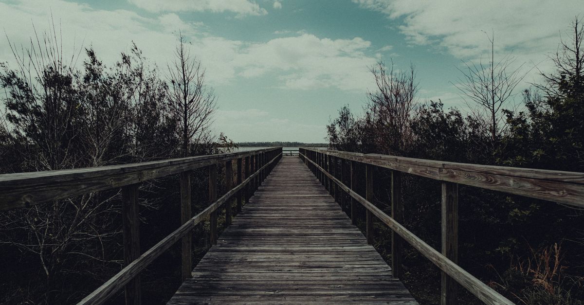
The boardwalk is the stretch people remember: it runs out toward Nassau Sound and ends across from the Sawpit Creek trailhead, with open water on both sides and marsh grass running out toward the horizon. The sightlines from out there are the reason to slow down rather than push through.
The George Crady Bridge alongside it is a fishing pier over the sound, not the trail's crossing. Continuing north across Nassau Sound to Amelia Island means riding the A1A highway bridge with traffic, so anyone who wants an entirely off-road outing should treat the Talbot Islands side as an out-and-back.
Other stops along the way: Peters Point Beach Park at the north end, a boardwalk overlooking Spoonbill Pond, and Boneyard Beach on Big Talbot Island.
That mix is what separates this from a fitness loop. The pavement is why a casual rider and a serious one can ride together without either of them compromising much. The sound, the marsh, and the beach access are why anyone goes twice.
How much does parking cost at the Timucuan Trail?
Trailhead parking runs roughly $2 to $5, according to Florida Hikes, so keep small bills or a card in a pocket. Leashed dogs are welcome on the trail itself, though not on the adjoining beaches, which is worth sorting out before you load the car with a dog and a beach plan.
A few things the maps will not tell you. A marsh has no shade to offer, so carry more water than the distance suggests. Wind over open water rarely favors both directions, and an easy ride out toward the sound often means a slower ride back. From June into September, the sensible ride here is an early one, before the heat sets in and the afternoon storms build inland.
How long does it take to ride the trail?
The trail takes anywhere from an hour to a full day, because the corridor works as three different outings rather than one.
An hour gets you a straightforward out-and-back from a single trailhead, enough for the bridge and the view and not much else. A half day covers the run between the island and the Talbot Islands with time to stop at the Spoonbill Pond boardwalk and walk down to the beach. A full day is the version where the parks themselves are the point and the trail is how you move between them.
Which state parks does the trail connect?
Counting the linked state-park segments, more than 10 miles of paved pathway now connect Amelia Island State Park, Big Talbot Island State Park, and Little Talbot Island State Park. The corridor keeps growing, too, with a further extension south to Kathryn Abbey Hanna Park in Jacksonville reported as planned.
Read that as infrastructure rather than recreation. A paved, protected connection between three state parks, with a fourth destination on the drawing board, is the kind of amenity that gets built once and then quietly shapes how a place is used for the next thirty years. It rarely comes up on a house tour. It shows up constantly in the calendar afterward.
Is the Timucuan Trail the same thing as the Timucuan Preserve?
No, the trail and the preserve are different places that share a namesake and very little else.
The Timucuan Ecological and Historic Preserve is a federal unit established by Congress in 1988, spanning about 46,000 acres between Jacksonville and Amelia Island. It is named to honor the Timucua people, who lived in the St. Johns River valley for thousands of years before European contact. It is a destination in its own right, with its own access points and planning considerations, and it earns a separate trip rather than a paragraph here.
The trail is a paved bike and pedestrian corridor. The preserve is a protected landscape with historic sites inside it. Both carry the Timucua name for the same reason, and neither substitutes for the other on a Saturday.
How many miles of bike trails does Amelia Island have?
Amelia Island has roughly 40 miles of casual and advanced bike trails, by Nassau County's count as reported on the City of Fernandina Beach's trails page, and this corridor is one piece of that. The same page lists a Timucuan Island Trail System Map among its published trail resources, which is the clearest sign that the name is in active official use here and not a label invented by a guidebook.
The other anchor sits closer to town. The Egans Creek Greenway is a protected area of more than 300 acres running north and south along Egans Creek, opened in summer 2000, with grass-covered paths, benches, and interpretive displays.
The two are not interchangeable, and the difference starts with the surface underfoot. Egans Creek is grass and quiet, better on foot, closer to the north end and to downtown. The Timucuan corridor is asphalt, better on wheels, pointed south toward the sound and the Talbot Islands. An island that offers both is offering two genuinely different mornings.
| Timucuan corridor | Egans Creek Greenway | |
|---|---|---|
| Surface | Paved asphalt, with boardwalk sections | Grass-covered paths |
| Best for | Cycling, longer distances | Walking, birding, short outings |
| Where | South end, across Nassau Sound to the Talbot Islands | North and south along Egans Creek, near town |
| Size | 8.16 to 8.4 miles of main trail, more than 10 miles linked | More than 300 protected acres |
| Parking | Roughly $2 to $5 at trailheads | City greenway access points |
Why does a trail like this matter when you buy a home?
A trail like this matters because it reshapes the part of everyday living a house tour almost never covers: the ten minutes after you back out of the driveway, which usually decide whether a place still fits in year three. The tour covers the house, and stops at the driveway.
A protected paved corridor changes those ten minutes. A bike ride becomes a decision made in the moment instead of a small logistics project involving a rack and a drive. The south end of the island reads differently on a map than it does through a windshield, because the distance between a house near Peters Point and a boardwalk over Nassau Sound is measured in pedal strokes rather than in miles of A1A. And the beach stops being the only outdoor thing you do here, which matters more than people expect in a place where the beach is the headline.
Think of it as a piece of the property that no seller paid for and no appraiser will list. Proximity to a protected trail corridor reshapes a weekly routine in a way a countertop upgrade never will, and it holds its value regardless of what happens to finishes and fashion.
There is a practical version of this. When you are comparing an address on the south end against one closer to downtown, the honest question is not which house shows better. It is which one puts the life you intend to live within easy reach on an ordinary Tuesday. That question deserves to be asked out loud, with the map in front of you, and it is the part of a search I care most about getting right. If you are weighing neighborhoods on Amelia Island, I am glad to walk through what each one puts within reach.
Which trailhead should you start from?
Start at Peters Point and ride the Amelia Island side south toward the sound if you want the marsh views and the option to turn back at any point. If the Talbot Islands boardwalk is what you came for, drive to a Talbot trailhead and ride from there, with the parks as the destination. Either way, the corridor gives you something rare on a barrier island: real distance on pavement, away from cars, with the marsh doing the entertaining.
Some places are defined by the view from the porch. Others are defined by what you can reach without starting the car. Love Where You Live.
Frequently asked questions
How long is the Timucuan Trail?
Trail-mapping services measure the main segment at 8.16 to 8.4 miles of paved asphalt, depending on which endpoints are counted. Florida State Parks describes about six miles of it running north to Peters Point Beach Park on Amelia Island. Counting the linked state parks, more than 10 miles of paved pathway are now connected.
Do you have to pay to park at the Timucuan Trail?
Parking fees at the trailheads run roughly $2 to $5. Bring small bills or a card rather than assuming a free lot.
Can you bring a dog on the Timucuan Trail?
Leashed dogs are welcome on the trail itself. They are not permitted on the adjoining beaches, so plan the route accordingly if a beach stop is part of the day.
Does the Timucuan Trail cross Nassau Sound to Amelia Island?
The trail's boardwalk runs out toward Nassau Sound and ends across from the Sawpit Creek trailhead. Continuing north across the sound to Amelia Island means riding the A1A highway bridge with traffic, so an entirely off-road outing means treating the Talbot Islands side as an out-and-back.
Is there shade on the Timucuan Trail?
Very little. The route runs through open marsh with no shade to offer, so carry more water than the distance suggests. From June into September the sensible ride is an early one, before the heat sets in and the afternoon storms build inland.
Is the Timucuan Trail off-road?
For most of its length, yes. The paved path sits off the road, parallel to A1A, which is what makes it usable by riders who would never share a shoulder with beach traffic. The exception is the A1A highway bridge over Nassau Sound, which the trail shares with traffic.
What can you see along the Timucuan Trail?
Stops include Peters Point Beach Park at the north end, the boardwalk out toward Nassau Sound, a boardwalk overlooking Spoonbill Pond, and Boneyard Beach on Big Talbot Island. The George Crady Bridge alongside the trail is a fishing pier over the sound rather than part of the route.
Sources reviewed
- Florida Hikes -- Timucuan Trail, Talbot Islands
- TrailLink -- Timucuan Trail
- Amelia National Golf & Country Club blog -- Pedal Power: Ride the Timucuan Trail
- Amelia National Golf & Country Club blog -- Pedal Power: Ride the Timucuan Trail
- National Park Service -- Timucuan Ecological and Historic Preserve
- City of Fernandina Beach -- Trails
- City of Fernandina Beach -- Trails